
No Business 100 – 2027
For 2027 the course will be clockwise starting from the group camp at Pickett State Park in Fentress County towards Blue Heron and then over to the Bandy Creek Area. This is the events 11th year and our 8th providing communications support. The No Business Hundred is a trail endurance race that begins and ends at the Group Camp in Pickett CCC Memorial State Park. The course is a single 102 mile loop that traverses through the heart of the Big South Fork National River & Recreation Area starting in Tennessee then crossing the state line into Kentucky and back on some of the oldest trails in the southeast.
Joe Cross N4YLA returns as our ham radio coordinator once again, reach out to Joe directly or to our club at W4BSF at BSFARC.ORG as we could use some help at select aid stations.
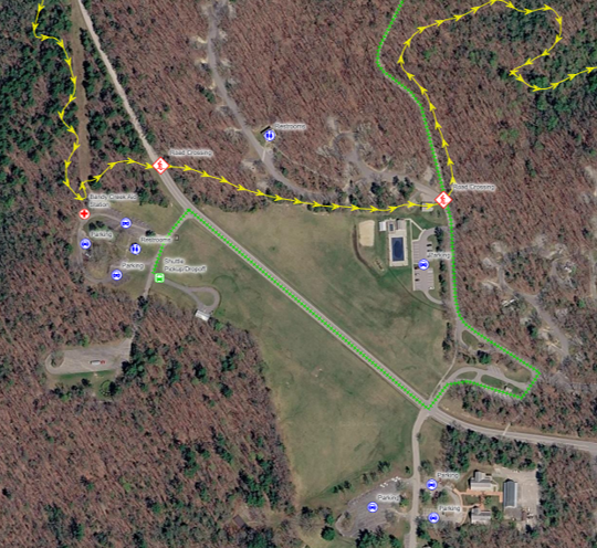
This aid station is adjacent to the trail head restrooms and the available parking fills quickly. There is limited electrical service at this location and a 100′ extension cord is required to reach the aid station setup at the end of walkway to the restroom.
● Directions from Pickett: https://maps.app.goo.gl/5qmXiYaeyrYzncD37
● Drive Time: 25 minutes (16.0 miles)
● Parking: Bandy Creek is a large campground facility for the Big South Fork. The aid station will be located at F Loop by the Oscar Blevins Loop Trailhead. Crews should use established parking lots within the Bandy Creek area, including the lot adjacent to the pool and other designated parking areas throughout the campground. ABSOLUTELY DO NOT PARK IN FIELDS OR ON GRASS.
● Facilities: Restrooms, Playground, NPS Visitor Center, Campgrounds
● Cellular/Wi-Fi: We will have Wi-Fi provided by Highland Telephone Cooperative for the duration of the race at Bandy Creek. Cellular service is spotty.
● Safety Note: Runners and pedestrians will be moving through the Bandy Creek area. Drive slowly, follow all NPS and race signage, and use extreme caution throughout the campground. ABSOLUTELY DO NOT PARK IN FIELDS OR ON GRASS.
Charit Creek
Peters Mountain to Ledbetter – 36 minutes http://ow.ly/7Ei750BCmoX
Stearns to Spring Branch – 35 minutes http://ow.ly/oWsm50BCmhX
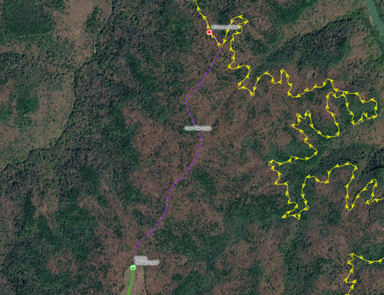
Ham radio operators should plan on taking only one venicle as parking is pretty limited. The runners crew will be using a shuttle bus to/from Bandy Creek. There is no bathroom at this aid station so plan accordingly.
● Facilities: None
● Cellular/Wi-Fi: There is poor to no cellular coverage. There is no Wi-Fi.
Peters Mountain
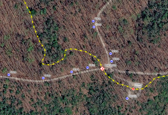
DIRECTIONS: From Stearns Train Excursion (27 Bridge Street, Stearns KY 42647)
Head towards or continue on West on KY-92W/State Hwy 1651. Continue on KY-92W for 5.4 mi
Turn left on State Hwy 1363 and continue for 11.0 mi
Turn left onto Bell Farm-Fidelity Oak J Rd/Rock Creek Rd 0.1 mi
Turn right onto Old Fidelity Bell Farm Road 0.1 mi
Continue straight onto CR-12420/Peters Mountain Rd and the aid station will be about 4.2 mi near the where Devils Creek-Beech Grove Rd intersects
● Coordinates: 36.623803, -84.689793
● Directions from Blue Heron: https://maps.app.goo.gl/ssqnk276wS4aMELT8
● Drive Time: 57 minutes (30 miles)
● Parking: Volunteers/crew may park along Divide Road and Peters Mountain Road only where they can pull completely off the traveled portion of the gravel road. Both wheels on the road side of the vehicle should be off the roadway so emergency vehicles, race staff, and other traffic can pass freely. DO NOT block or narrow the road. Parking immediately adjacent to the aid station may be limited, so crews should be prepared to park farther away and walk to the aid station. Follow all race staff and volunteer parking instructions.
● Facilities: Restrooms
● Cellular/Wi-Fi: Cellular coverage is available by the aid station and restrooms.
Safety Note: Please be alert for runners coming off the trail and heading into the aid station area.
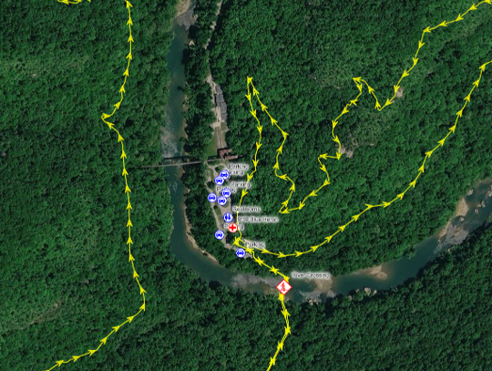
While typically not staffed by radio operators it remains a key communication hub for the race. Runners will do a loop here which aids to the confusion at the aid station.
● Coordinates: 36.668943, -84.547512
● Directions from Bandy Creek: https://maps.app.goo.gl/xD1GKCkKJ9mAGLsE9
● Drive Time: 1 hour, 2 minutes (39 miles)
● Parking: Plenty of parking is available in the large 100+ space parking lot.
● Facilities: There are restrooms onsite.
● Cellular/Wi-Fi: We will have Wi-Fi provided by Highland Telephone Cooperative for the duration of the race at Blue Heron.
● Comments: You can search “Blue Heron Mining Community” in most mapping services to get directions. The aid station is located at the concession area.
● Runners will access this same physical aid station twice.
● Safety Note: Pay close attention to posted speed limits in the Blue Heron area and drive carefully.
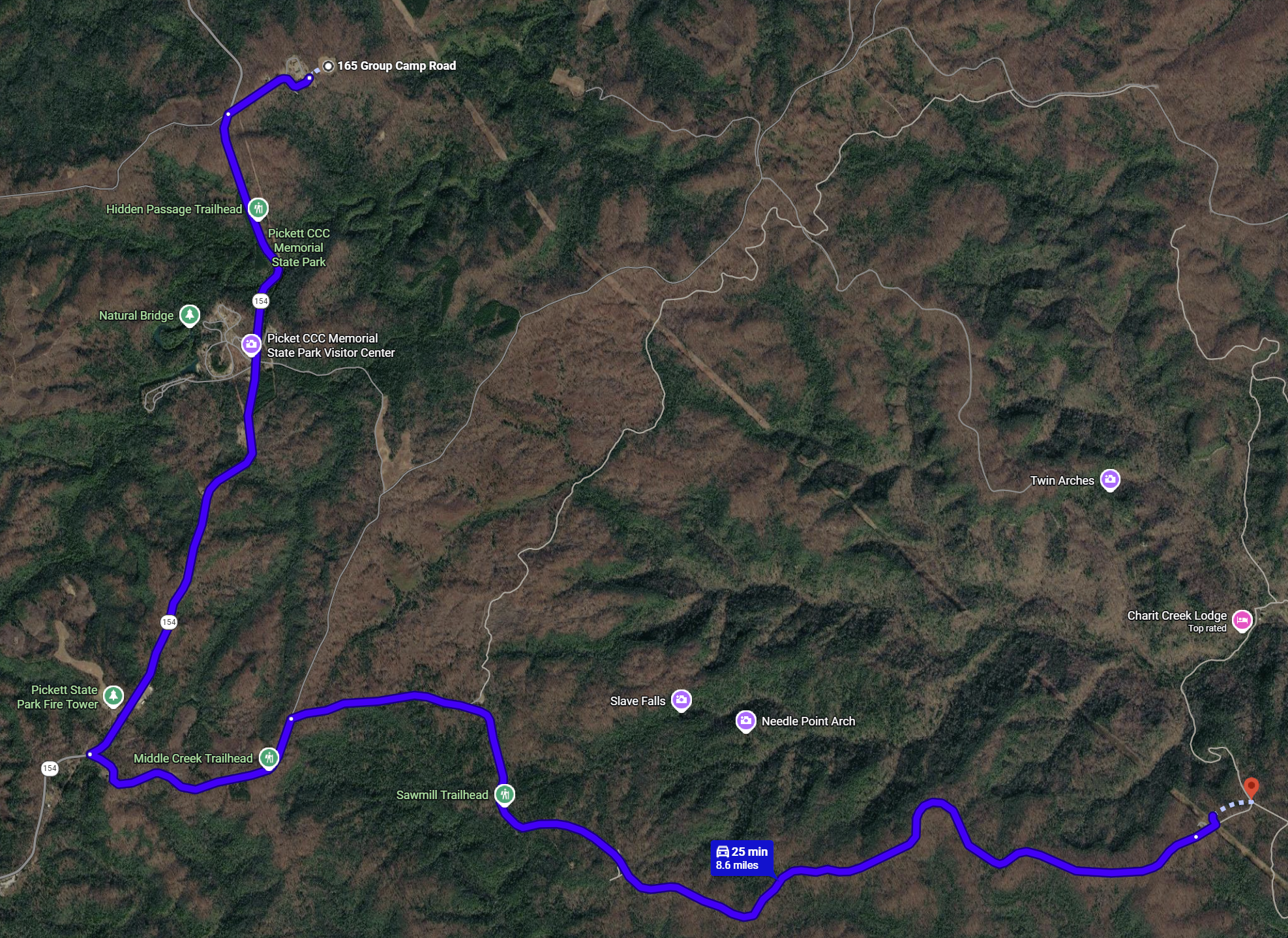
DIRECTIONS: From Group Camp (165 roup Camp Road Jamestown, TN 38556) a total of 8.9 miles which will take about 30 minutes.
Slight left onto TN-154 S go 2.7 mi
Turn left onto Divide Rd and travel 4.1 mi
Continue onto Divide Rd for another 0.5 mi
Turn left onto Blevins Cemetery Road the aid station is about 1.3 mi
From Group Camp (165 Group Camp Road Jamestown, TN 38556)
Turn right onto TN-154 N go 4.1 mi
Enter Kentucky
Continue onto KY167 N for another 0.2 mi
Turn right into Lonesome Creek Road/Parkers Creek Mountain – Fireroad 564 for another 6.6 mi
Slight right onto Bell Farm-Lonesome Creek Road/Parkers Creek Mountain – Fireroad 564, Follow Bell Farm- Lonesome Creek Road for 1.5 mi
Sharp right onto Bell Creek-Bell Farm Road and the aid station will be about 4.6 mi
Each aid station will either be staffed with a communications team member (ham radio operator) or equipped with a radio that volunteers themselves will be able to use to communicate with our communication staff. The communications staff will be able to relay any aid station needs or concerns. We want to keep the radio airways clear for the most part unless the following things occur:
1. There is an emergency. (see Emergencies below)
2. Supplies such as water are getting low and need to be replenished.
3. You are reporting a runner who is dropping out of the race or missed the aid station cutoff time. Also advise if transportation for a runner that has dropped.
4. Your aid station is closing and we need to do a final check on runners to make sure they have cleared your aid station. This is best done when the sweeper(s) arrives. A sweeper is a volunteer who follows behind the last runner to make sure all runners get through the course.
Things you should bring
● 2-meter radio(s) if using an HT consider an extra battery or a way to charge. An antenna other than a rubber-duck style
● Clipboard with paper & pens. A highlighter may be useful as well
● A listing of frequencies to be used
● A means of checking time which could be a cell phone or a watch
● Camp chairs – we will not be providing chairs
● Water bottle
● Food and snacks
● Cooler/Ice/Beverages
● Sunscreen
● Bug spray
● Extra clothing for all weather conditions
● Lantern and/or Headlamp (if you will be there overnight)
● Extra batteries including a way to charge a cell phone if needed
Aid Stations for 2027
1 – Blevins Cemetery
2 – Great Meadows
3 – Peters Mountain
4 – Spring Branch
5 – Piney Butte
6/7 – Blue Heron
8 – Ledbetter
9 – Laurel Hill Ken N4KAP
10 – Duncan Hollow from 7:00PM Friday to 7:00AM Saturday
11 – Grand Gap 8:30PM Friday to 9:30AM Saturday
12 – Bandy Creek 9:30PM Friday to 11:00AM Saturday
13 – Charit Creek 10:00PM Friday to 12:30PM Saturday
14 – Sawmill 11:30PM Friday to 3:00PM Saturday
15 – Pickett State Park
AID STATION DIRECTIONS
Drive time from designated pick-up areas.
1. Group Camp to Aid 1 Blevins Cemetery – 26 minutes http://ow.ly/DSgW50BCmtZ
- Group Camp to Aid 2 Great Meadow – 46 minutes http://ow.ly/88gl50BAy6Q
- Peters Mountain to Aid 9 Ledbetter – 36 minutes http://ow.ly/7Ei750BCmoX
- Stearns to Aid 4 Spring Branch – 35 minutes http://ow.ly/oWsm50BCmhX
- Stearns to Aid 7 & 8 Blue Heron – 18 minutes http://ow.ly/Rnqx50BCmeE
- Stearns to Aid 9 Ledbetter – http://ow.ly/H2IN50BCmnU
- Group Camp to Aid 10 Laurel Hill – 50 minutes http://ow.ly/bb5450BAxYO
- Bandy Creek to Aid 11 Duncan Hollow – 19 minutes http://ow.ly/NER650BAxJK
- Bandy Creek Aid Station Aid 12 http://ow.ly/4ilR50BAxth
- Bandy Creek to Aid 12 Grand Gap – 19 minutes http://ow.ly/ojVV50BAxFe
- Group Camp to Aid 13 Sawmill – 14 minutes http://ow.ly/gUS450BAdUJ
- Group Camp to Aid 14 Charit Creek – 25 minutes http://ow.ly/2ePV50BAe8u
- Group Camp to Aid 16 Pickett Park Rec Center – 3 minutes http://ow.ly/HpIy50BAdHD